


Protecting tidal wetlands
UD scientists study tidal flow, sediment movement in Kent salt marsh


12:53 p.m., April 17, 2013--According to a 2007 report by the Intergovernmental Panel on Climate Change, global sea level is expected to increase one half meter or more over the next century. Along the Mid-Atlantic coast of the United States, relative sea-level rise is about two times higher than the global rise.
In Delaware, nearly 371,000 acres of contiguous tidal wetlands surround the Delaware Bay. Studies indicate that the proportion of wetlands that were degraded increased from 25 percent in 1984 to an alarming 54 percent in 1993.
Research Stories


Chronic wounds
Prof. Heck's legacy
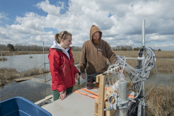
Three University of Delaware scientists are studying tidal water flow and sediment movement in a Kent County salt marsh to better understand changes to the marsh ecosystem due to a rising sea level.
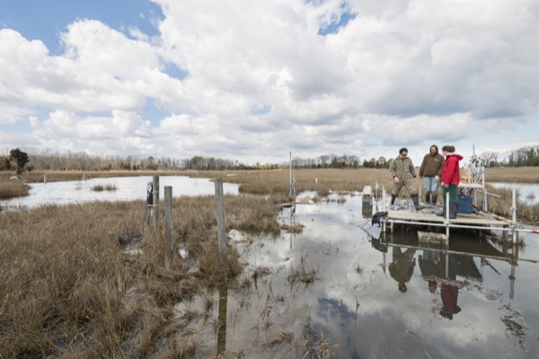
Brockonbridge Marsh is a tidal wetland adjacent to Brockonbridge Gut, a small tidal creek located approximately 24 miles upstream from the mouth of the Delaware Bay. It is characterized by daily tidal flooding and extensive cordgrass vegetation.
Increasing rates of sea level rise could convert this tidal wetland to an intertidal flat, an environment where muddy sediment can be quickly eroded. This conversion to an intertidal flat has the potential to alter water quality by releasing large quantities of sequestered carbon, nutrients and pollutants, and could affect wildlife such as birds, crabs and fish that live in coastal marshes and waters.
“Developing new methods to quantify water and sediment movement in these wetlands, on marsh surfaces and in small tidal channels will provide critical information related to marsh stability. This information is needed to predict future changes,” said Jack Puleo, associate professor of civil and environmental engineering and in the Center for Applied Coastal Research.
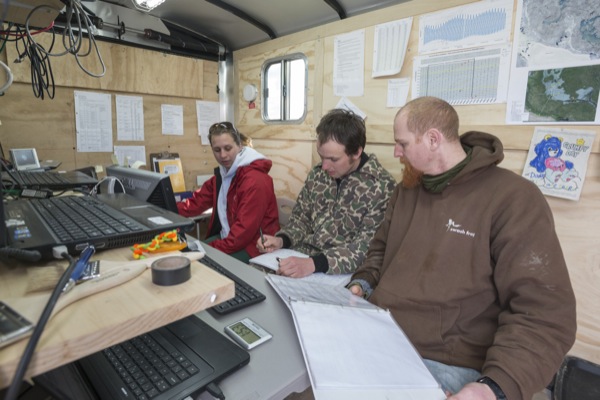
Puleo is collaborating with Thomas McKenna, a hydrogeologist with the Delaware Geological Survey and associate professor of geological sciences, and Aline Pieterse, a doctoral student studying geological sciences. The team worked in the field for over three weeks in March and April to quantify the hydrologic processes across the intertidal flat, particularly how tidal forces move water and fine-grained sediment in and out of tidal channels cut into the marsh platform during many, but not all, high tides.
“While this study necessarily focuses on a single marsh in Delaware, the data and techniques developed can be applied at other tidal wetlands, both within and beyond Delaware’s borders,” remarked McKenna.
It may also inform ecologists about how tidal dynamics affect the ecosystem, particularly whether it alters the marsh’s biogeochemistry or affects certain plant or animal species currently living there.
To perform the study, the research team developed an innovative imaging system that included thermal infrared sensors. Sensing hydrologic processes in tidal wetlands is difficult with only visible-band imaging, a technique commonly used along sandy coastlines, explained Puleo, because there are no obvious high contrast signatures such as waves.
“Our analysis used heat to track the water’s path,” added Puleo, who, along with McKenna, Pieterse and a rotating team of graduate and undergraduate students, remained on-site around the clock during the experiment.
The research team deployed over 40 sensors on the tidal flat to measure water flow and sediment concentration while the imaging system, mounted on a 17-meter tall retractable mast and operated by remote control, allowed them to capture images from live video feeds of the marsh over time. Reference marks in the imagery, surveyed with a global positioning system, enabled them to analyze the recorded images using real-world coordinates.
According to Puleo, this is the first experiment of its kind to simultaneously record imagery and millimeter-scale velocity profiles in this type of soft, muddy environment.
“Improved predictive models are needed if scientists and engineers are to understand, and potentially mitigate, the negative effects on marshes exacerbated by rising sea levels,” he said.
The research team’s work is supported in part by Delaware Sea Grant.
Access to Brockonbridge Marsh was provided by Delaware Wildlands Inc., a non-profit conservation and preservation organization. Accommodations for the research team were supplied by the South Bowers Sportsman’s Club.
Article by Karen B. Roberts
Photos by Evan Krape