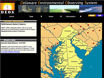
Launched in the summer of 2003, DEOS is a real-time regional monitoring system that provides data on weather conditions, stream levels, tidal conditions, snow depth, water quality and many other environmental variables. At present, DEOS has 156 different data types defined.
DEOS observations can be found at [www.deos.udel.edu], where current, daily and monthly information is displayed along with graphics and network summaries. The DEOS web site also features Delaware Geological Survey well-water levels, water quality data and RSS feeds as well as access to the raw data through XML. The site also provides links to other related web services (for users who fill out an online registration form), as well as DEOS news archives and monthly state of Delaware climate roundups.
State agencies having special interest in services provided by DEOS include the Delaware Emergency Management Agency (DEMA), the Delaware Department of Natural Resources and Environmental Control (DNREC), and the Delaware Department of Transportation (DelDOT), David R. Legates, associate professor of geography and Delaware state climatologist, said.
“We currently have 24 weather stations located throughout the state, and in Cecil County, Md., and Chester County, Pa., that gather data at five-minute intervals,” Legates said. “The information we provide helps decision makers monitor emergency situations during potentially dangerous weather events, including tropical storms, nor'easters and major snowfalls.”
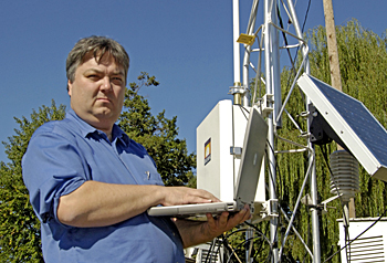
Online observation data obtained from weather stations in and around the state include real-time and time-specific rainfall, air temperature, dew-point temperature, relative humidity, barometric pressure, solar radiation, wind speed, wind gust, wind direction and soil moisture and temperature data. All stations are solar-powered and some additionally include vegetation wetness sensors and sonic depth detectors to measure snow depth, Legates said.
The system also incorporates data from offshore ocean buoys, stream gauges, ground water level and water quality monitoring in conjunction with the Delaware Geological Survey and the Delaware National Estuarine Research Reserve, Legates said.

Genesis of DEOS
The aftermath of major weather events, such as Hurricane Floyd in 1999 and the severe flooding in the Glenville community in 2003 brought on by the remnants of Tropical Storm Henri, heightened interest in a central environmental monitoring system for Delaware and the Delmarva Peninsula.
Given the wide variety of weather across Delaware's three counties, it became apparent to state agencies that the decision makers need to rely on more than just the single weather station located at the New Castle County Airport near New Castle, Leathers said.
“Before DEOS, individual data were distributed across a number of agencies and web sites,” Leathers said. “Some data were never archived and were lost for research use. It's nice for users, including agencies and academic researchers, to have all this information available at just one site.”
An additional feature of DEOS, not available with most other observing networks, is the Triggers for Emergency Response facility. “Monitoring requires more than just storing data,” Legates said. “We have the ability to notify emergency managers, decision makers and research scientists 24/7 via cellular telephone about developing conditions of which they need to be made aware. This can speed up the emergency response and provide more proactive decisions, but it also can provide scientists with notification of developing conditions that may be vital to their research.”
The installation of DEOS began in the summer of 2003 and development of the system has been ongoing ever since. This fall, DEOS will expand its coverage to include Chester County, Pa., through cooperation with the Chester County Department of Emergency Services.
“The idea is to be a real-time and historical repository for data that covers the state, the estuary and the off-shore area--for management and scientific purposes,” Legates said. “DEOS data are transmitted to the National Weather Service every half hour to assist with their weather forecast models and decision making and is available for use by federal, state and private agencies and organizations when special environmental conditions are occurring.”
Because environmental conditions do not stop at state and county borders, information from DEOS stations is combined with information being collected by other organizations, including the Southeastern Chester County Refuse Authority, the Delaware Solid Waste Authority, the National Weather Service, the U.S. Geological Survey and the Delaware Geological Survey, which operates a network of tidal and stream gauges throughout the region, Legates said.

Legates also noted that state agencies also like the idea of having observations available from an academic research institution when determining which communities or areas are eligible for reimbursement based on environment-related conditions or events.
“Agencies often want accurate information from a third party--an independent source--so there is little concern that the agency has changed the data to make their case,” Legates said. “That's why something like DEOS is best housed in an academic setting.”
Article by Jerry Rhodes


