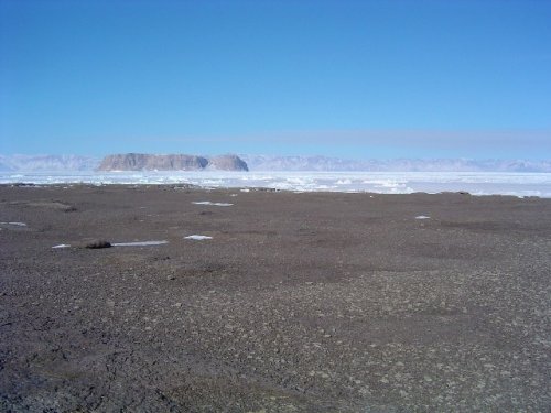
This is the site of our 2-month field camp near Lafayette Bay on northern Greenland.
()
Supplies, equippment, and some scientific gear will be dropped from aircraft probably April-4, most scientists will
leave their home institutions about April-8 to perhaps arrive at the field site about April-12.
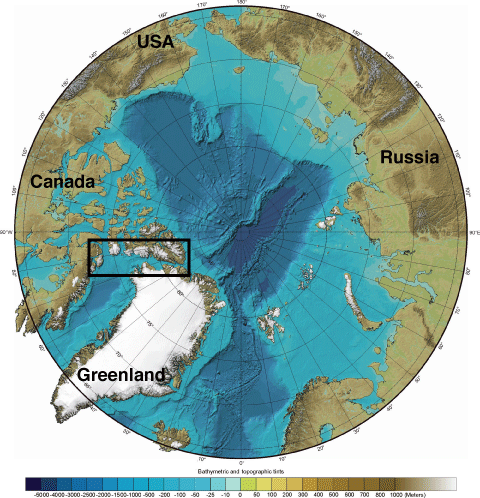
The map below shows the general study area between northern Greenland and Canada. Adjacent icesheets and
mountain ranges, and the narrow Nares Strait will all complicate operations for aircraft and people. High and
unpredicted wind bursts are likely. At sub-freezing temperatures, it's the wind that may cause the most serious
threat to people and equippments.
|